U.S. Great Lakes Waterfront Trail
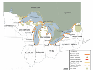 Imagine a binational recreation trail along the largest chain of freshwater lakes in the world, connecting countries and communities through bicycle and pedestrian pathways along spectacular scenery. By linking existing trail networks, the U.S. Great Lakes states can create the U.S. Great Lakes Waterfront Trail as a companion to Canada’s Great Lakes Waterfront Trail.
This trail would be a collaborative effort of the eight Great Lakes States, building on the foundation of existing and planned trails and complete trail gaps over time. The goal would be to welcome as many non-motorized uses as possible and provide unforgettable trail experiences along the Great Lakes, promote and enhance local trails, and serve as a gateway to these continentally significant natural resources and their region.
Mapping Process
The National Park Service Rivers, Trails, and Conservation Assistance (RTCA) program awarded CSG Midwest a technical assistance grant to work with stakeholders across the eight Great Lakes states to map a potential route for the Great Lakes Waterfront Trail. The RTCA map will cover existing and planned trails, as well as identify gaps.
The completed map is expected to be shared in fall 2026.
Support the U.S. Great Lakes Waterfront Trail
The U.S. Great Lakes Waterfront Trail program is currently accepting letters of support from organizations, as well as donations to support this work. If you are interested in becoming a part of this effort, please reach out to Jess Lienhardt at jlienhardt@csg.org
Supporting Organizations


![]()
![]()
![]()
![]()
![]()
![]()


Great Lakes Waterfront Trail Starter Guide
The US GLWT aims to connect waterfront trails along the largest chain of freshwater lakes in the world. The 4000-mile-trail will bridge countries and communities and bring tourism and economic opportunities to Great Lakes communities.
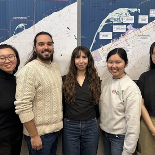
To make this vision a reality, a team from the University of Michigan made a new starter guide for trail design, specifically to make it easier for the average person to advocate, protect, and enhance the trails special to them. The starter guide empowers community members to advocate and care for their favorite trails.
As stated by the Pennsylvania Department of Conservation and Natural Resources (2020), “Trails are no longer just for walking, hiking, and biking; they are adapting to serve the needs of growing and diversifying trail uses such as mountain biking, horseback riding, e-biking, kayaking, and motorized trail riding.”
Trails led by communities that care are trails made to last. The UofM starter guide opens up the world of trail design to anyone and everyone, all to continue showing the world what makes the Great Lakes region such a unique place.
The SEAS-GLWT Starter Guide (also referred to as Starter Guide) is intended for anyone passionate about improving trails in the Great Lakes region. This could mean residents of a local community, members of grassroots community organization, municipal governments, non-profits, and any other individual or group interested in trails designed for communities.
Users of the Starter Guide should be able to:
- Be prepared to approach local planning, environmental, and governmental bodies with trail design options and ideas to further local trail improvement
- Understand the considerations and processes that go behind trail design
- Understand how to utilize the accompanying resources to further the trail planning process
- Identify relevant trail types for trails of interest
- Review lessons learned from applying trail design processes to the pilot site
- Learn about different considerations when applying Starter Guide principles to local communities


Dr. John Hartig and National Park Service Rivers, Trails, and Conservation Assistance planner Christopher Morgan are delivering a…
Read More